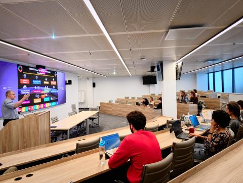
On October 6, OSUN's GeoHub project hosted an insightful talk by Lorant Czaran, Scientific Affairs Officer at the United Nations Office for Outer Space Affairs (UNOOSA). The hybrid event was a part of the UWC "Introduction to Geospatial Data Visualization". The open lecture took place at the CEU Campus in Vienna and was broadcasted for a wider OSUN community.
Serving as a Chief of the UN Platform for Space-based Information for Disaster Management and Emergency Response (UN-SPIDER) Vienna Branch, Mr. Czaran provided invaluable insights into the UNOOSA's role in the context of the United Nations. The talk particularly focused on the application of satellite imagery resources within the framework of the UN Early Warnings for All Initiative. This initiative holds significant importance in supporting the key global efforts within the UN Secretary-General's Acceleration Agenda, the Paris Agreement, the Sendai Framework for Disaster Risk Reduction, and the 2030 Agenda for Sustainable Development.
The event was an opportunity for participants to gain insights into the crucial work of UNOOSA on the prevention of human and economic losses caused by disasters such as floods, storms, and wildfires, the number of which had drastically increased over the last decades. Sharing the concern, Mr. Czaran highlighted the importance of ensuring that all countries have access to space-based information (Earth observation, positioning, and communication satellites) to support the full disaster management cycle from prevention and preparedness to rapid response, including emergency mapping as well as post-disaster needs assessment.
The meeting proceeded in a productive and inclusive spirit and provided a chance to learn more about how space-based technologies are revolutionizing the disaster management field. Mr. Czaran highlighted the cooperation in international satellite information exchange as one of the main areas for improving the quality of emergency responses across the globe. Following the presentation, the participants had a chance to ask a range of questions regarding their concerns on the peaceful and sustainable utilization of outer space and the office's practices in collaborating with experts in the field of environmental monitoring.
GeoHub is an open platform project aimed at developing the capacity of the Open Society University Network (OSUN) members to use the latest geospatial methods and technologies in research and teaching disciplines. The project is conducted in partnership between CEU, AUCA, and Bard College.